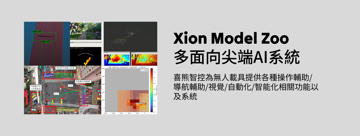
Multi-oriented cutting-edge AI systems can be deployed at the edge (airborne computers), on the ground (GCS), in handheld remotes, and on cloud servers.
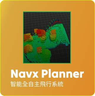
3D Gaussian-Splatting Gaussian Field
Utilizing Gaussian field technology, it breaks through the limitations of traditional two-dimensional images and realizes precise three-dimensional spatial reconstruction and perception, opening up new horizons for automated tasks in complex environments.
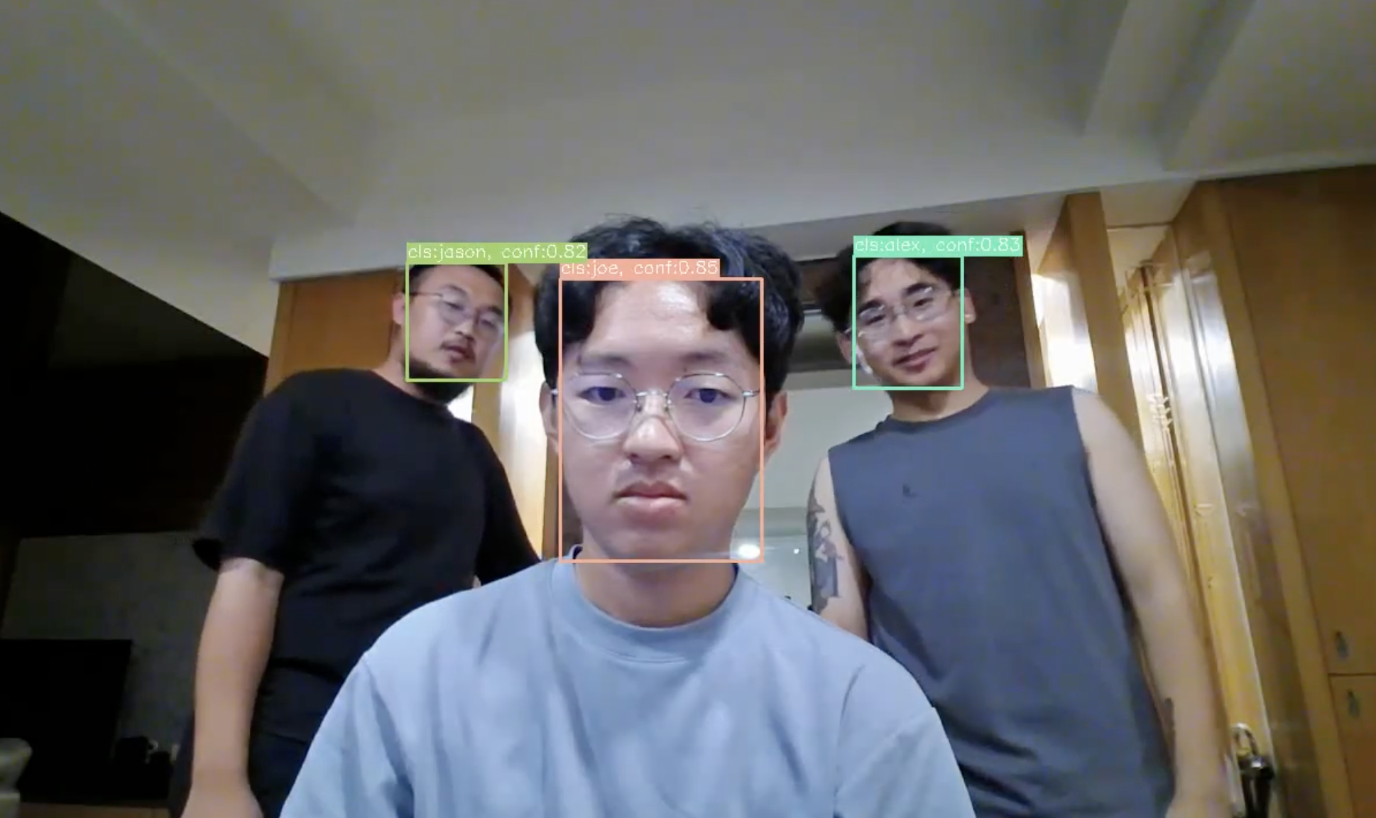
Object Recognition + ID Tracking
Through advanced object recognition technology, it accurately identifies and locks onto the target, and utilizes an ID tracking system to achieve efficient and reliable continuous monitoring and tracking.
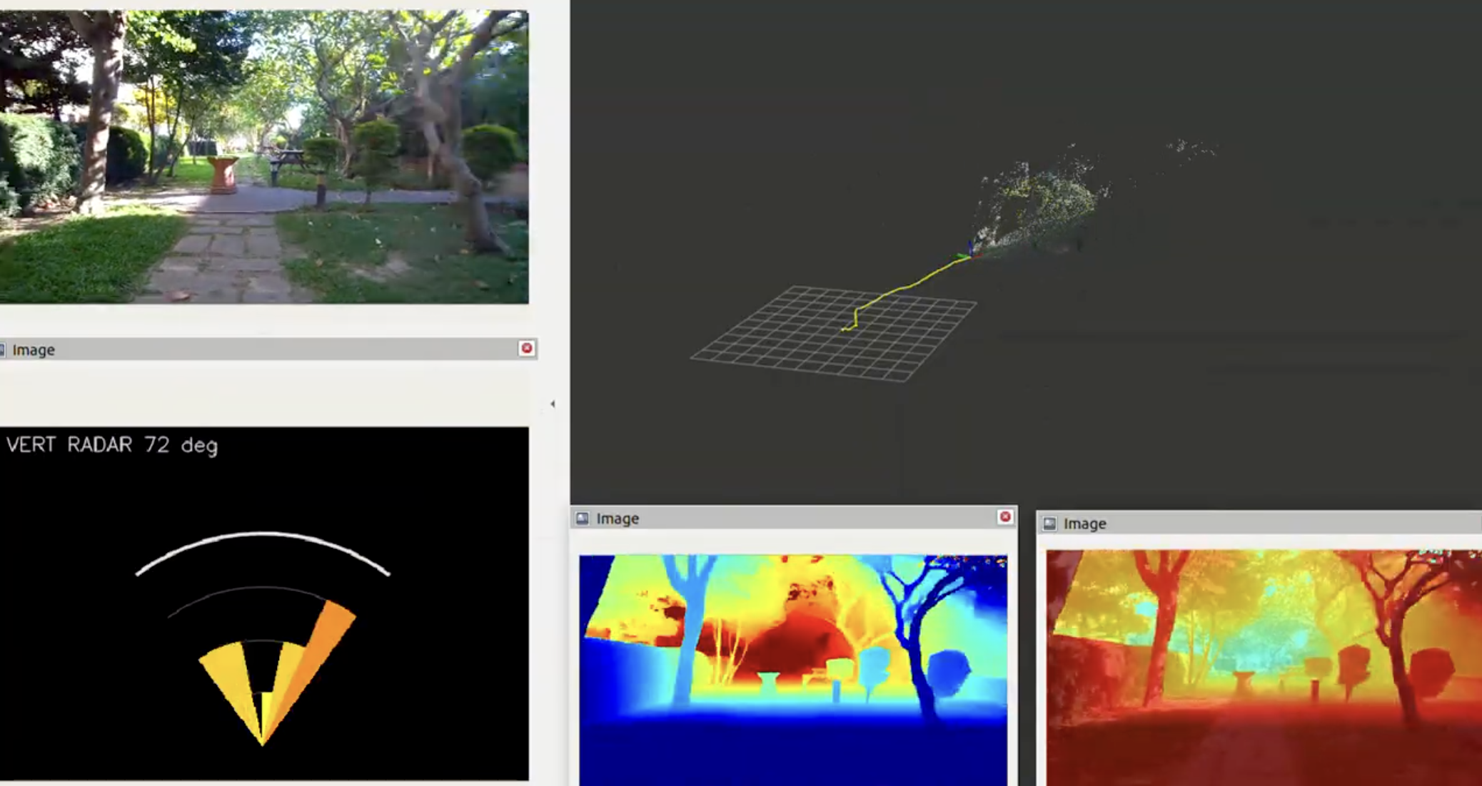
Depth estimation of individual items
The ability to accurately perceive three-dimensional depth information of the environment from a single camera image provides critical vision capabilities for automated drone missions in complex environments.
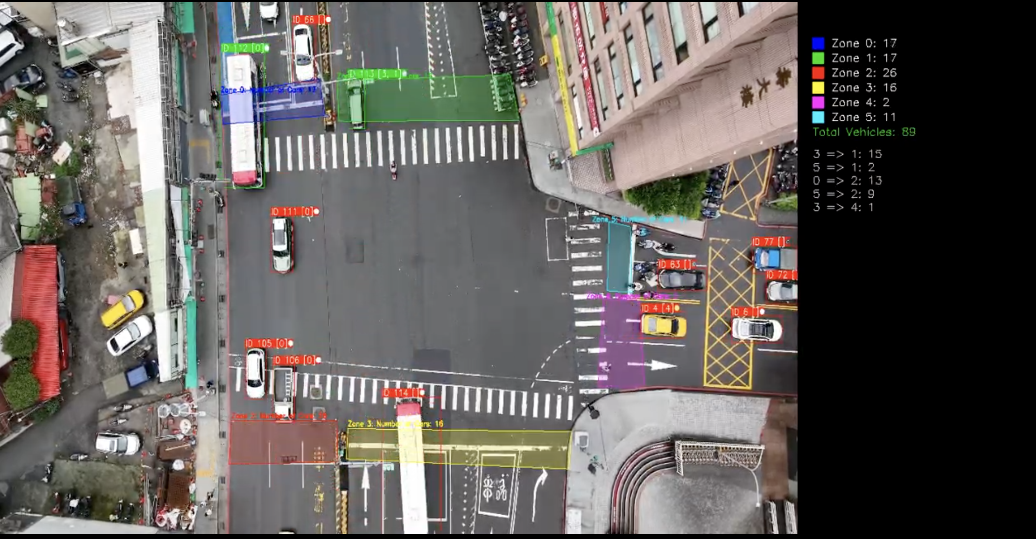
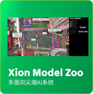
Vehicle Flow Detection
Accurately analyzes intersection traffic and provides real-time data to optimize traffic signal control and road planning, effectively enhancing urban traffic efficiency.
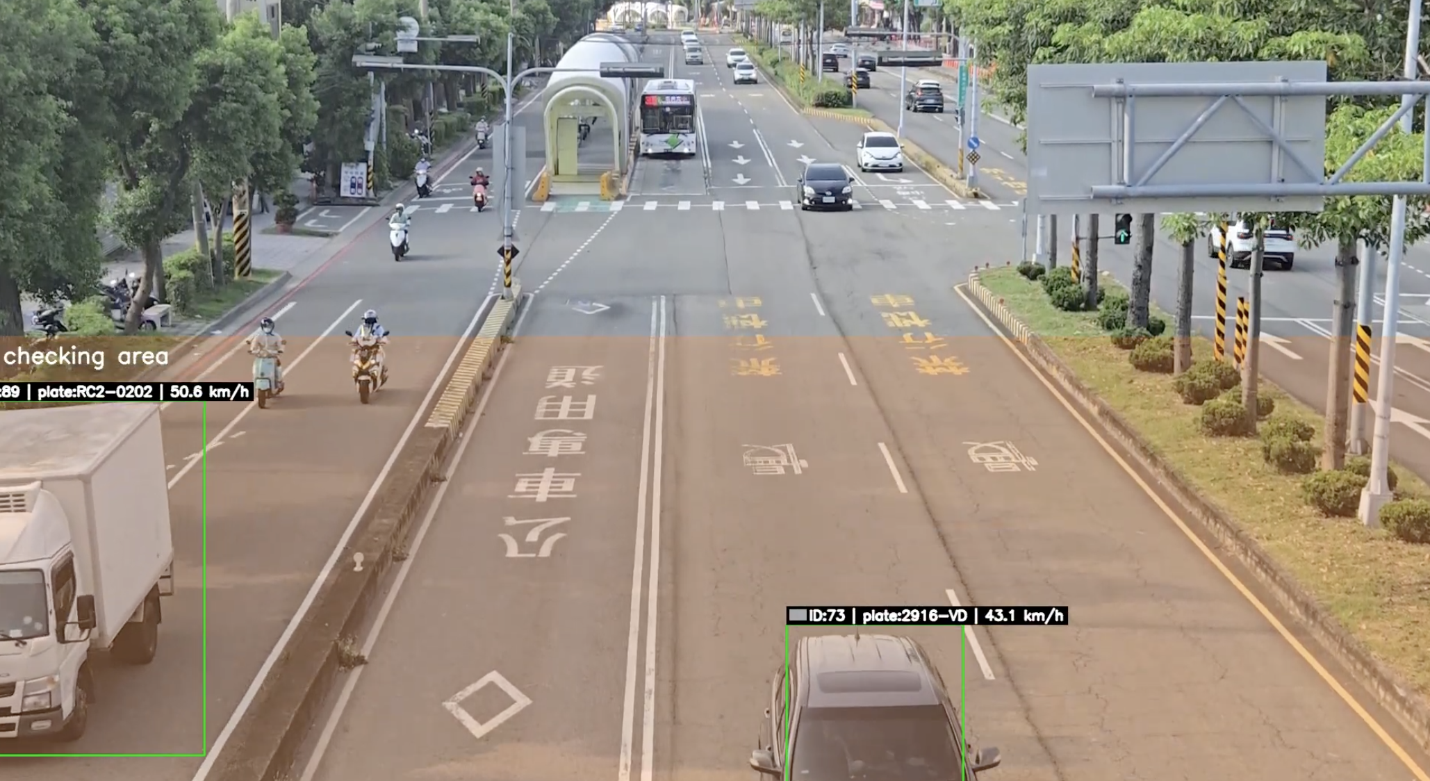
Speed and license plate recognition
Accurate speed measurement and license plate recognition provide revolutionary solutions for traffic enforcement, security monitoring and smart city management.
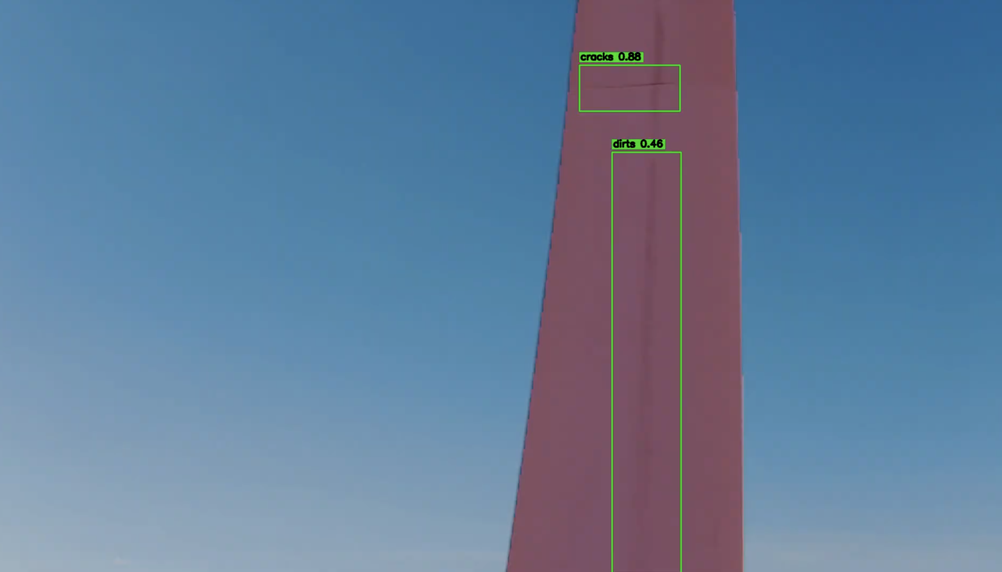
Abnormality Detection (Fan Inspection)
Efficiently identifies leaf cracks, corrosion and other problems, dramatically improving maintenance efficiency and safety.
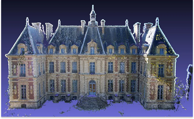
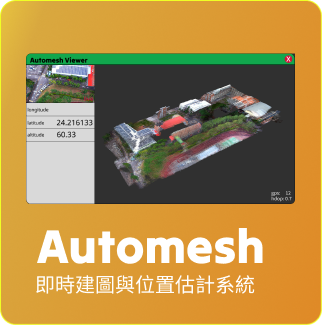
3D reconstruction
- Mesh-based 3D modeling optimization for rapid generation and refinement of 3D models
- Mesh Optimization algorithm to improve model efficiency and quality while preserving geometric details.
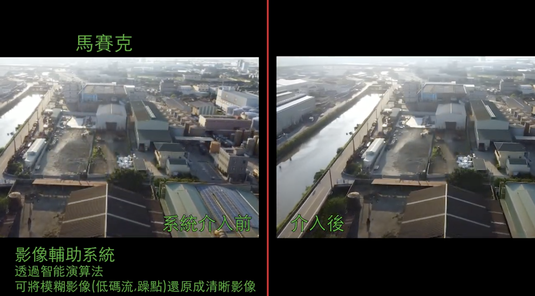
Real-time image enhancement system
Realtime Video Stream Augmentation
When UAVs are performing missions, the image quality often deteriorates due to poor communication quality, limited bandwidth, or jitter and blurring caused by strenuous movements. With the efficient computing resources on the ground, the system can perform real-time image enhancement processing to restore low-quality images to a water-quality level, so that clearer and more stable images can be obtained for subsequent algorithmic analysis or real-time viewing by personnel.
Current features include (10fps):
Image Deraining: Effectively removes raindrop interference to maintain a clear and stable image.
Motion Deblur: Fixes motion blur and restores sharp details.
Gaussian Denoise: Reduces Gaussian-type noise and improves picture purity.
Demosaic Removal: Resolves mosaic images caused by poor transmission and restores the real picture.
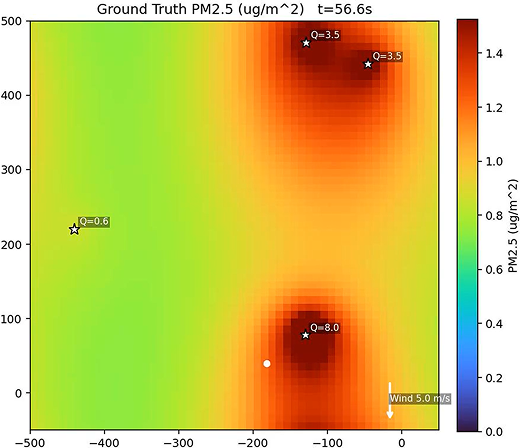
Real-time pollution monitoring map
- Simultaneous Collection of Air Pollution Data by Unmanned Vehicles during Inspection Flights
- Generate high-resolution pollution concentration maps in real time
- Generates 2D and 3D maps
- Highlight contamination hotspots and outlier areas
- Automatic export of pollution distribution and change trend reports
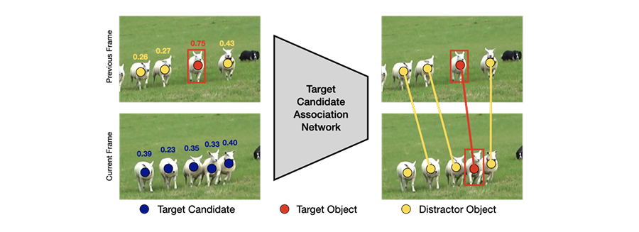
Monitoring without training Visual Tracking
Visual tracking is a real-time target tracking technology that does not require additional training data, just frame the target on the screen and start tracking immediately. The system will continue to analyze the image frame and dynamically update the target position, which is suitable for variable and unknown scenes with stable performance in high-speed motion and complex environments.
- Adopts the latest ViT architecture for more stable and accurate tracking.
- Supports multi-target tracking, recognizing multiple objects at the same time.
- Ability to maintain differentiation in dense scenes of similar objects